Dakota Agros

Dakota Agros · Flagship Platform by Dakota AI LLC (West Fargo, ND)

From Drone Flight to Breeder-Ready Plot Data.

Turn field-trial orthomosaics into audited stand counts, 50% bloom dates, and canopy metrics—backed by human-in-the-loop review and peer-reviewed accuracy.

⬇ Download Sample Plot Deliverable (.ZIP)

No form required — includes Moorhead_Trial_Plot_Summary.csv, Moorhead_Sample_Detections.geojson (QGIS/ArcGIS ready), and our 2-page Validation Brief PDF.

Built in the Red River Valley for plant breeders, research agronomists, seed companies, and Contract Research Organizations (CROs).

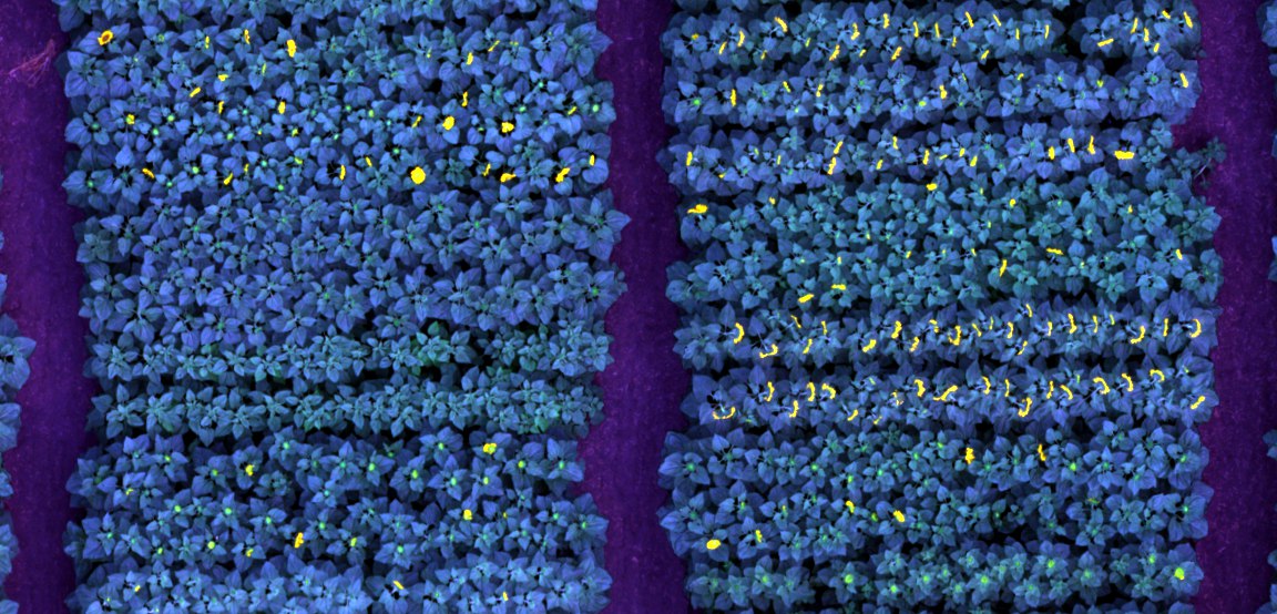
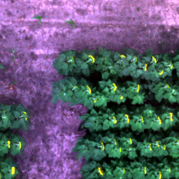
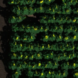
Cropped field imagery showing sunflower rows and yellow blooms
HelioVision field workbench Audited plot counts ready for ANOVA & BLUPs.

Inspect center-row plant stands, open blooms, and canopy height metrics on real Red River Valley trial plots—then export clean CSV and GeoJSON files.

Open the interactive workbench ↗
Trial Orthomosaic (GeoTIFF) + Plot Map → Automated Trait Extraction → Human-in-the-Loop QA Audit → Breeder-Ready CSV & GeoJSON (R / SAS / Agrobase)

Two ways to work with Dakota Agros

Choose turnkey plot tables
or the custom model workbench.

Most breeding teams and CROs just want clean phenotypic spreadsheets without managing computer-vision pipelines. Imaging teams who want to train custom visual detectors can license the underlying workbench directly.

PATH B · FOR IMAGING & REMOTE SENSING TEAMS

The Agros Workbench

Have your own drone pipeline and need to detect a custom visual trait? Use the Agros 4-step workflow to review candidate detections, export training chips, and train custom models.

01 Prepare → 02 Review → 03 Export training chips → 04 Iterate
  • Inspect and edit candidate polygons across RGB, multispectral, and CHM/TPI layers
  • Export clean image chips and bounding-box / mask annotations with dataset splits
  • Train and evaluate custom trait detectors for disease lesions, weed escapes, or specialty crops

Proven against ground truth

Drone calls that match
the field notebook.

We compared Agros bloom measurements to ground-rated 50% bloom notes from 877 sunflower plots across three 2021 yield trials at Moorhead, Minnesota. Flights and ground notes were not always taken on the same day.

BLOOM CALLS

90% agreement (94% calibrated)

Drone-measured bloom status matched ground ratings on 793 of 877 plots using a simple 50%-in-bloom rule. A threshold calibrated on one trial reached 94% on the other two.

WHERE THE MISSES ARE

83 of 84 within two days

Nearly every disagreement was a plot whose ground-observed 50% bloom date fell within two days of the flight. The misses are timing, not misreads.

BLOOM DATE

Within 0.8 days on average

With flights six days apart, interpolated 50% bloom dates landed within 0.8 days of ground notes on average, and within two days for 92% of 264 plots.

Method: 2021 Moorhead, Moorhead Early and Moorhead Hybrids yield trials (raw, unadjusted drone output); plot bloom percentage from drone imagery compared to days-after-planting ground notes. Our founder is first author of the peer-reviewed UAV sunflower study: Olson et al. (2024), Agronomy Journal, doi:10.1002/agj2.21655. Results on other crops, traits and trials depend on imagery and label quality and are evaluated during scoping.

Off-Season Trial Validation · Hard-Drive Backlog Rescue

Have Unanalyzed Trial Imagery Sitting on a Hard Drive? Send Us One Orthomosaic.

Before budgeting for next season's field trials, test Dakota Agros on archival imagery you already flew. Send us one stitched trial orthomosaic (GeoTIFF) and plot boundary shapefile—plus your ground notes if you want a blind accuracy comparison.

SELF-SERVE PROOF · LIVE IN BROWSER

16 Interactive Workbench Demos & Sample .ZIP

We don't do unpaid custom processing—instead, we put 16 interactive multi-crop trials, 29 validated YOLOv8 models, and our full Moorhead CSV/GeoJSON/PDF deliverable package directly in your browser so your team can verify our output quality upfront.

FULL-TRIAL BENCHMARK · $500 CREDITABLE

$500 Full-Trial Validation Report

Send us one stitched archival trial orthomosaic (GeoTIFF) and plot boundary shapefile. Receive an audited CSV + GeoJSON plot table across the entire trial flight, plus a quantitative accuracy report against your field ratings—100% creditable toward a $1,500 pilot or seasonal contract.

Multi-crop readiness across northern trials

Crop & Trait Readiness Matrix

Validated in production on sunflower, and calibrated in a single flight for regional row crops, sugarbeet, canola, and pulse nurseries.

Crop Group Target Phenotypic Traits Deployment Status
Sunflower V-stage center-row stand count, row gap %, R5 open-bloom count, interpolated 50% bloom date, canopy height (CHM), foliar disease triage
Try Live Demo (Moorhead Plots) ↗
Turnkey Production (Validated on 877 plots)
Canola & Pulse Crops
Soybean, Dry Bean, Pea, Lentil
Early emergence stand count, canopy closure rate, soybean pod load yield counting, canola silique phenotyping, pea seed viability
Try Live Demo (Soybean Pod & Canola) ↗
Guided Pilot Ready (1-flight calibration)
Row Crops & Sugarbeet
Corn, Sugarbeet, Wheat, Potato
Emergence plant counts, 8-crop & 5-weed escape detection (Kochia, Waterhemp, Pigweed), wheat spike density, lodging %
Try Live Demo (Corn, Sugarbeet & 8-Crop/5-Weed) ↗
Guided Pilot Ready (1-flight calibration)
Seed Lab, Ear & Harvest Quality Assays
Germination, Maize Cobs, Seed Grading
Seed germination radicle count (93% mAP@50), corn ear/cob morphometry + ruler calibration, field pea seed viability (97.6%), soybean seed damage grading, cultivar ID
Try Live Demo (Seed Germination & Ear Lab) ↗
29 Validated Models Ready
Custom Visual Targets Wheat/soybean/corn disease lesions, UAV disease hotspots, wheat stomata conductance, canopy segmentation
Try Live Demo & Browse All 29 Models ↗
Custom Workbench Pilot (Prepare → Review → Train)

Per-Plot Managed Processing · Archival Validation · Guided Pilots

Prove the workflow
or scale across your trials.

Start with a $500 full-trial archival validation report (100% creditable), run a $1,500 guided pilot, or scope full-season per-plot processing below.

02 / GUIDED PILOT & ARCHIVAL VALIDATION

Prove accuracy on your own imagery first.

From $1,500 USD / scoped pilot · $500 full archival trial (100% creditable)

A low-risk entry engagement to validate Dakota Agros against your field notes—using existing archival orthomosaics or one upcoming flight.

  • Imagery and target-trait feasibility review
  • Labeling workflow setup and guided chip QA review
  • Audited plot-level CSV & GeoJSON deliverable package
  • Ground-note comparison & full-season scaling plan
Scope an archival validation or pilot ↗

See Deliverable Specifications for exact CSV/GeoJSON schemas.

Interactive Program Estimator

Per-Plot & Seasonal Trial Scoper

View Deliverable CSV/GeoJSON Specs ↗
Estimated Program Investment
$2,700 USD
600 total plot-flight units · $4.50 / plot-pass · QA-reviewed, timing set per project

Inspect the live field tools

Flagship interactive workbenches.

Explore saved Red River Valley trial plots, inspect multi-layer orthomosaics and 3D canopy point clouds, or download our sample deliverable archive directly.

WebGL Spatial Engine
LAS / LAZ / GeoTIFF
3D Canopy Height & Terrain Inspector
02 / FLAGSHIP 3D SPATIAL VIEWER

3D Point Cloud & Geospatial Viewer

Inspect photogrammetric LAS/LAZ point clouds, textured meshes, and GeoTIFF canopy & terrain surfaces directly in WebGL without desktop GIS dependencies.

29 Validated Multi-Crop, Weed & Seed Lab Models

Live Multi-Crop, Weed, Disease & Seed Lab Demos

Explore All 29 Validated Ag & Seed Lab Models ↗
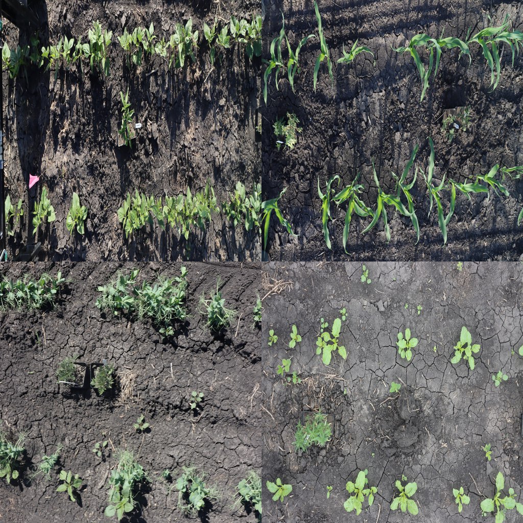
Northern Plains 8-crop and 5-weed detection trial tiles
NORTHERN PLAINS ROW CROPS + WEEDS

Northern Plains 8-Crop & 5-Weed Detector

Detects Canola, Field Pea, Flax, Soybean, Corn, Blackbean, Lentil, and Sugar beet alongside Kochia, Waterhemp, Pigweed, Ragweed, and Horseweed.

Launch 8-Crop & 5-Weed Demo ↗
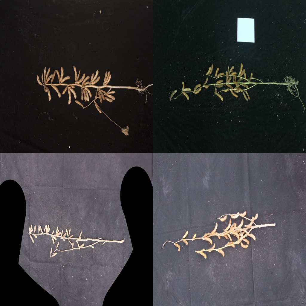
Soybean pod load and yield component plot tiles
SOYBEAN YIELD COMPONENTS

Soybean Stand & Pod Load Yield Counter

Counts in-field main-stem and branch soybean pods (70.5% mAP@50 across 42,983 pods) and V1 seedling emergence stands.

Launch Soybean Pod Demo ↗
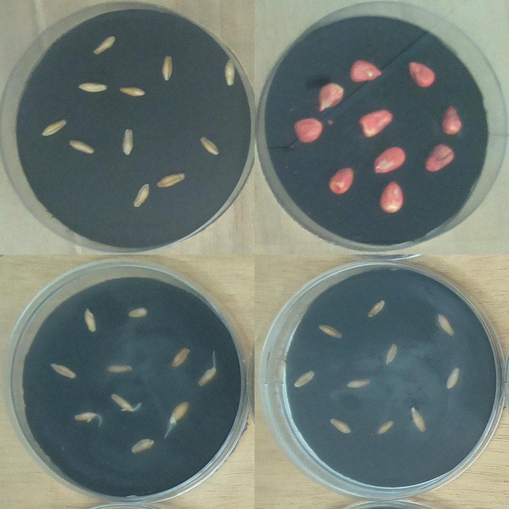
Seed lab germination radicle assay dish tiles
SEED LAB ASSAY · 93% MAP50

Seed Lab Germination Radicle Assay (93% mAP50)

Automates time-series germination scoring of emerged radicles vs. ungerminated seeds across breeding and conditioning batches.

Launch Germination Assay Demo ↗
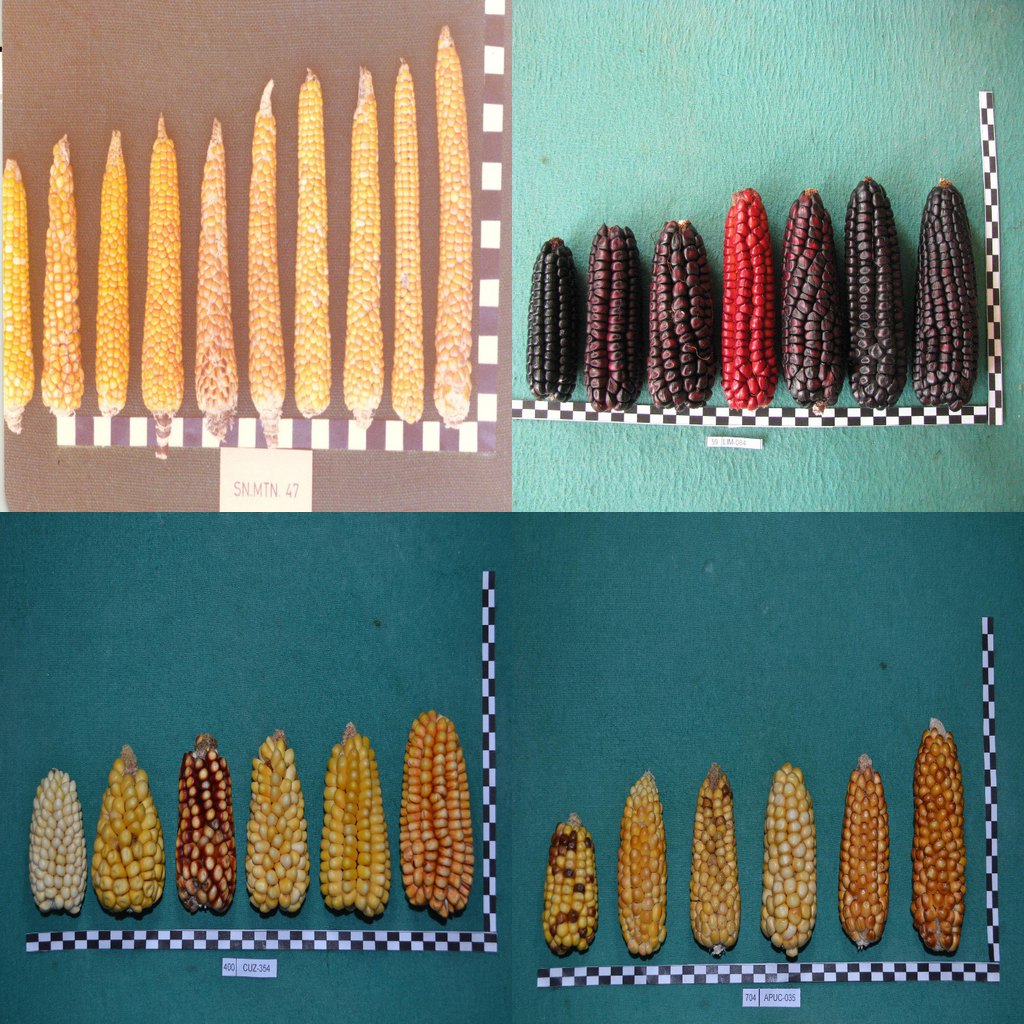
Harvested corn cob morphometry and calibration ruler tiles
CORN BREEDING · 83% MAP50

Corn Cob Morphometry & Calibration Ruler (83% mAP50)

Detects harvested maize cobs alongside scale calibration rulers for automated millimeter ear sizing and normal/abnormal kernel fill.

Launch Corn Cob Lab Demo ↗
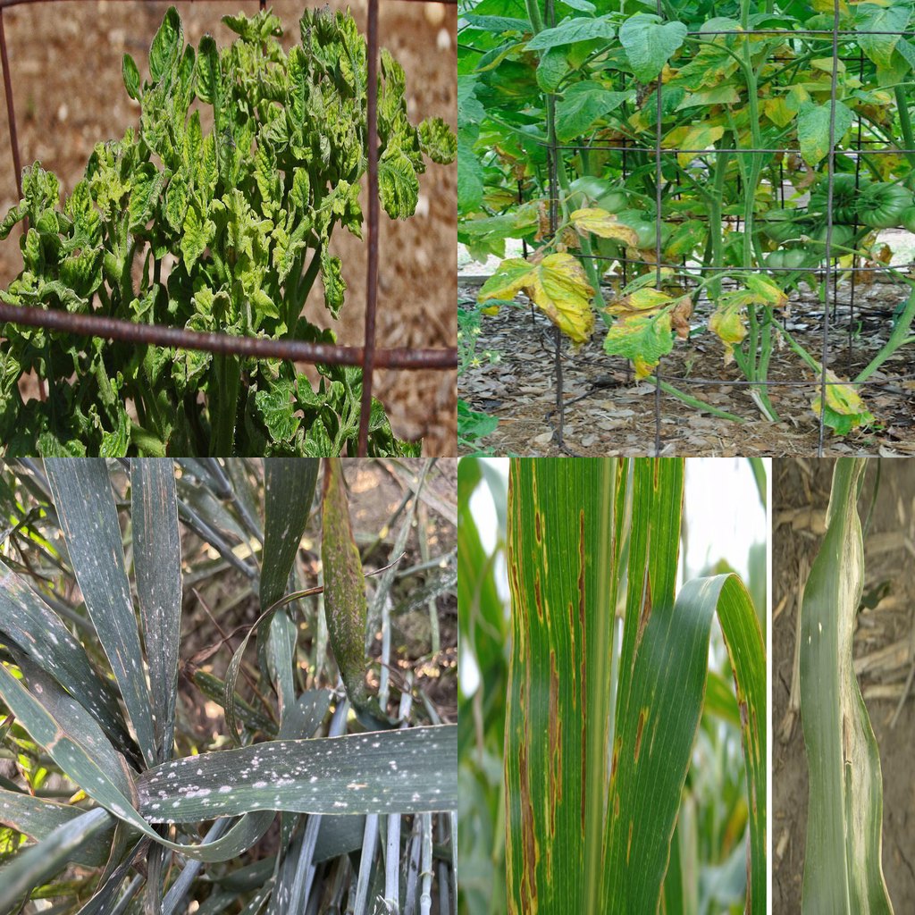
Wheat rust, Septoria, and foliar blight lesion tiles
PATHOLOGY & UAV HOTSPOTS · 92–96% ACC

Crop Pathology & UAV Disease Hotspot Suite (92–96% Acc)

Detects cereal rust/Septoria & foliar lesions and classifies Sunflower, Corn, and UAV Soybean diseases at 92–96% validation accuracy.

Launch Pathology Demo ↗
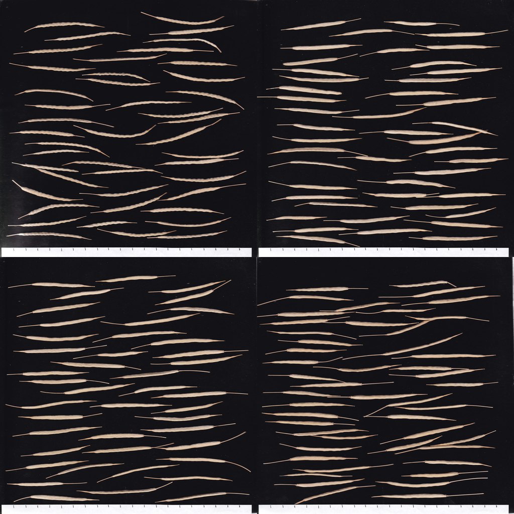
Canola silique flatbed scans pre-labeled for Agros active learning
PRE-LABELED ACTIVE LEARNING QUEUES

Canola Silique & Wheat Stomata Phenotyping Queues

Inspect raw flatbed canola siliques and spring wheat stomata imprints pre-labeled by our RTX 4090 checkpoints and export reviewed YOLO boxes.

Launch Canola Queue Demo ↗

Inspect the actual CSV, GeoJSON & PDF files first.

Download Dakota_Agros_Sample_Deliverable.zip containing 24 plot-flight summary rows, 48 georeferenced QGIS/ArcGIS features, and our 2-page validation brief—no form required.

Download Sample .ZIP ⬇

The engine powering turnkey processing (Path B for imaging teams)

How Agros audits every plot
and adapts to new traits.

Whether Dakota Agros processes your flights turnkey or your internal remote sensing team uses the workbench directly, every plot count passes through this four-step audited pipeline.

01 / PREPARE

Align imagery & plot grid

Ingest GeoTIFF orthomosaics, canopy height models, and trial plot boundaries; extract candidate plants, blooms, or custom targets.

02 / REVIEW

Human-in-the-loop QA

Inspect crowded rows, separate touching canopies, and eliminate false positives before any plot summary is locked.

03 / EXPORT

Deliver tables & chips

Generate breeder-ready plot CSVs and QGIS/ArcGIS GeoJSONs—plus reviewed training chips when calibrating a new trait or crop.

04 / ITERATE

Calibrate across trials

Verify agreement on held-out plots or ground notes and extend validated detectors across locations, dates, and varieties.

Before you begin

Questions breeding & trial teams ask.

How does the Winter "Hard-Drive Backlog Rescue" test work?

Start by inspecting our 16 interactive multi-crop demos in the HelioVision Workbench and downloading the sample .ZIP above. When you want to benchmark against your own imagery, send one stitched GeoTIFF orthomosaic and plot boundary shapefile (plus ground notes for a blind comparison) and we deliver a complete audited CSV + GeoJSON validation report across the entire trial for $500 (100% creditable toward a $1,500 pilot or seasonal contract).

What file formats do we receive in a Turnkey Plot Processing package?

You receive plot-level and row-level CSV files formatted for R, SAS, Agrobase, or BMS (with center-row vs. all-row stand counts, intra-row gap %, bloom counts, interpolated 50% bloom date, canopy height, and QA flags), georeferenced GeoJSON polygon layers for QGIS/ArcGIS Pro, and a visual QA brief. Download the sample .ZIP at the top of this page to inspect the exact files.

Can Agros handle crops besides sunflower?

Yes. Sunflower stand, R5 bloom, 50% bloom date, and CHM workflows are in Turnkey Production (validated across 877 plots in Olson et al., 2024). Canola, soybean, dry bean, pea, corn, sugarbeet, and potato emergence/canopy/lodging workflows are Guided Pilot Ready with a single-flight calibration pass.

How long does the $1,500 pilot last?

The starting price covers one scoped pilot project, not a fixed three-month term, yearly subscription, or lifetime access. Before payment, your written proposal defines the dataset, deliverables, delivery schedule, and included support period. Ongoing service, new projects, extra training, and hosted access require a separate agreement; there is no automatic renewal.

Where will my research data go, and who owns it?

Data transfer, isolated processing, retention, and deliverable rights are agreed in your pilot proposal before imagery is shared. You retain 100% exclusive ownership of your raw orthomosaics, plot maps, and exported phenotypic tables. Please use the inquiry form for project scoping only; do not send confidential files through it.

Let's start with your trial

Ready to validate an archival
flight or scope next season?

Tell us the crop, approximate plot count, imagery format (GeoTIFF/shapefile), and target traits to scope a $500 full-trial archival validation report or $1,500 guided pilot.

Prefer email? [email protected]

Your inquiry is sent to Dakota AI through Formspree so we can respond. Please don't include confidential research files.

An inquiry is not a purchase or commitment.

About Dakota AI LLC · West Fargo, North Dakota

Dakota Agros is the flagship agricultural computer-vision platform built by Dakota AI LLC, alongside our Zero-Exposure Enterprise R&D engines.

Founded by Neil Olson, M.S. (dual graduate degrees in Plant Sciences and Data Science; first author of Olson et al., 2024, Agronomy Journal; FAA Part 107 pilot).